

Raised-relief map 3DMAP Bauges-Belledonne-Chartreuse
Original price was: £34,71.£10,41Current price is: £10,41.
Description
- Raised-relief map Bauges-Belledonne-Chartreuse
The topographic map3DMAP Bauges-Belledonne-Chartreuse provides a highly detailed overview of the region. Thanks to a technological process specifically created for its realization, the reliefs of the mountains stand outto offer immersion and a better understanding of the specific features of the area. A wealth of informationis provided, including hydrological, natural, hypsometric and administrative data. Tourist, sports and hiking sites are also included, so you can prepare for your next excursion to the area.
Characteristics of the 3DMAP Bauges-Belledonne-Chartreuse:
- Dimensions: 410 x 610 mm
- Planimetric scale: 1 / 185,000
- Altimetric scale: 1 / 120,000
- Recreational and educational use
- Made in France
This description is an automatic translation. Please contact us if you have any further questions.
Technical data Raised-relief map Bauges-Belledonne-Chartreuse
-
Gender
MenWomen
-
EAN code
9791097206284
-
Reference nr
3DMA0206853
-
SKU
BBC32
-
Destination
France
Related products
-
Sale!
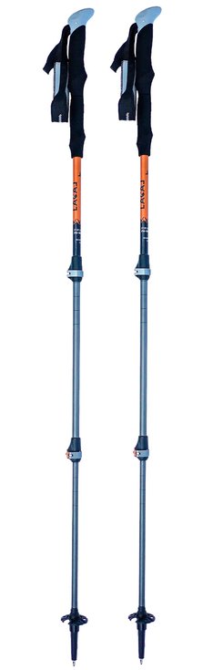
Poles Lacal Alu Stick Light 135 Orange
Original price was: £42,57.£12,77Current price is: £12,77. -
Sale!
-
Sale!
-
Sale!
Reviews
There are no reviews yet.